r/TropicalWeather • u/Euronotus • 12d ago
Dissipated 28W (Western Pacific) (South of Japan)
Storm overview
This discussion is for Tropical Depression Twenty-eight (28W), which is active over the western Pacific.
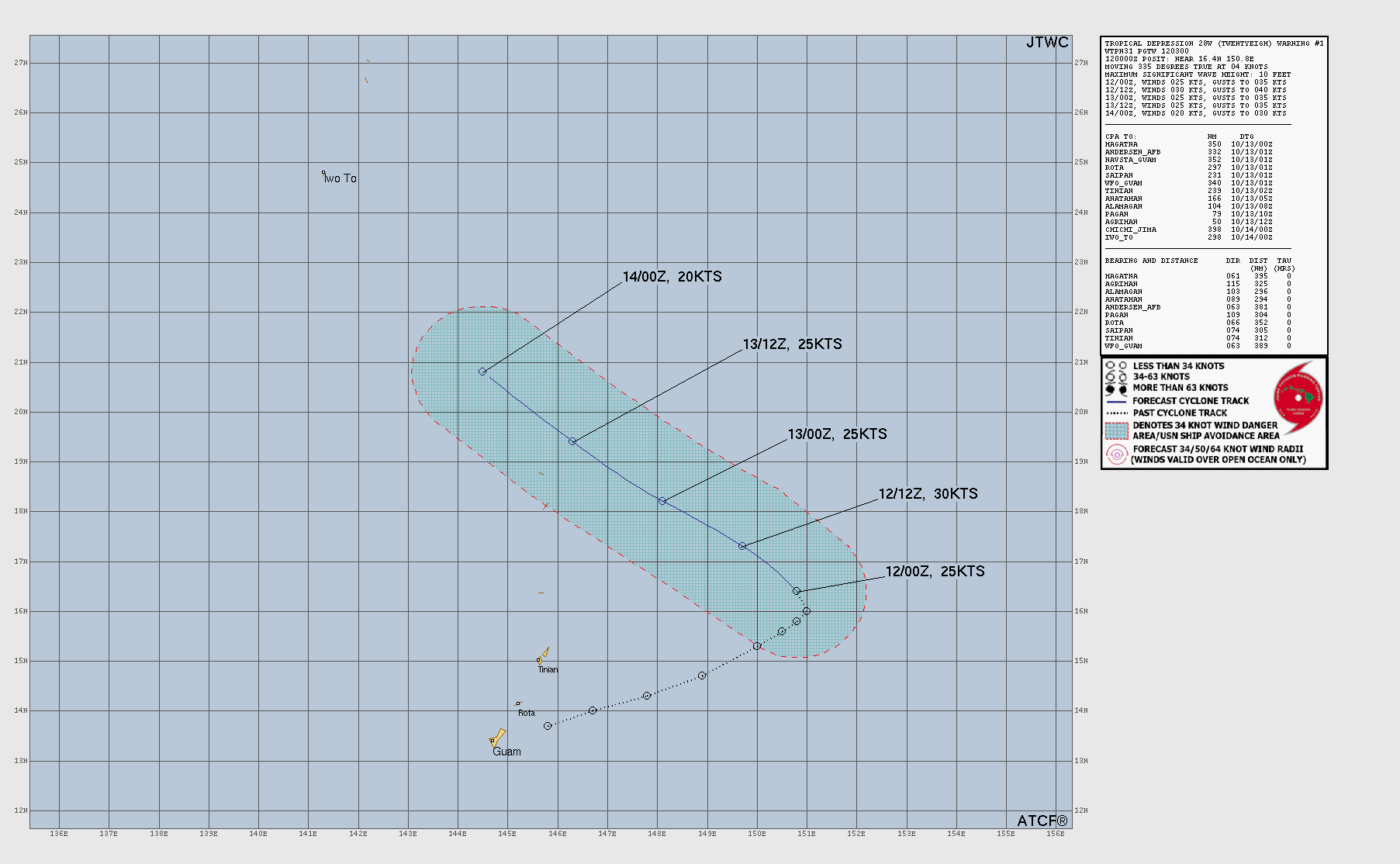
A tropical depression remains active a few hundred kilometers southeast of Iōto in Japan’s Ogasawara Islands. The depression has not undergone any significant changes in strength or structure over the past several hours; its low-level center remains exposed and only a few isolated bursts of deep convection continue to flare up to the southwest. This system continues to move toward the west-northwest under the steering influence of a deep-layered subtropical ridge positioned to the northeast. Upper-level convergence associated with a trough positioned directly above the depression is suppressing any potential for outflow development, preventing the depression from developing in an otherwise highly favorable environment.
This system is likely to stop producing persistent thunderstorm activity and will degenerate into a remnant low as it passes well to the south of Iōto by the end of the week.
Official information
Japan Meteorological Agency
Though the JMA does classify this system as a tropical depression on its surface analysis and prognosis charts, it has not initiated issuing tropical cyclone warnings for it.
Joint Typhoon Warning Center (United States)
- Homepage
- Outlook discussion
- Tropical cyclone warning (text product)
- Tropical cyclone warning (graphical product)
Radar imagery
Radar imagery is not currently available for this system.
Satellite imagery
Floater imagery
Visible imagery
- via Tropical Tidbits
- via CyclonicWx
Infrared imagery
- via Tropical Tidbits
- via CyclonicWx
Water vapor imagery
- via Tropical Tidbits
- via CyclonicWx
Multiple bandwidth imagery
- via CIMSS
- via CIRA/RAMMB
- via Naval Research Laboratory
Regional imagery
Visible imagery
- via CIRA/RAMMB
- via Tropical Tidbits
- via CyclonicWx
Infrared imagery
- via CIRA/RAMMB
- via Tropical Tidbits
- via CyclonicWx
Water vapor imagery
- via CIRA/RAMMB
- via Tropical Tidbits
- via CyclonicWx
Analysis products
Observational history
- via NCAR Research Applications Laboratory
- via NaTyphoon (not fully updated)
Scatterometer data
- via EUMETSAT
- via CyclonicWx
Sea-surface temperatures
Forecast models
Storm-centered guidance
Multi-model guidance
Single-model click-through guidance
Tropical Tidbits
CyclonicWx
Ensemble model guidance
PolarWx
- Individual ensembles (GEFS, EPS, CMC, UKMET, ICON, AIFS, FNV3, GenCast)
- Superensemble (Samples GEFS, EPS, CMC, and UKMET)
- Grand ensemble (Samples all ensembles)
Regional guidance
Global models
TropicalTidbits
CyclonicWx
Weather Nerds
Ensemble models
Tropical Tidbits
CyclonicWx
Weather Nerds
Machine learning models (AI)
Tropical Tidbits
CyclonicWx
Weather Nerds
Other types of model guidance
Tropical Cyclone Genesis Guidance: Florida State University
Cyclone Phase Diagrams: Florida State University