r/geography • • 5h ago

Map The density of Sugar Maples almost exactly lines up with the places that are commonly said to have the best fall colors

Post image
954 Upvotes

The Upper Pensula and Northwoods, Adirondacks and northern New England, the Ohio valley and Appalachia. All of these places are commonly said to have the best fall colors in the country, and those regions are also where the highest density of sugar maples are.

One of the best trees in the world, simply stunning in fall.


r/geography • • 7h ago

Question Why are tornadoes common in that small region of Australia?

Post image
204 Upvotes

It is oddly specific how that small particular region is way more prone to tornadoes than its surroundings. The coast of Eritrea has a similar situation despite being significantly larger than that bit of Australia


r/geography • • 20h ago

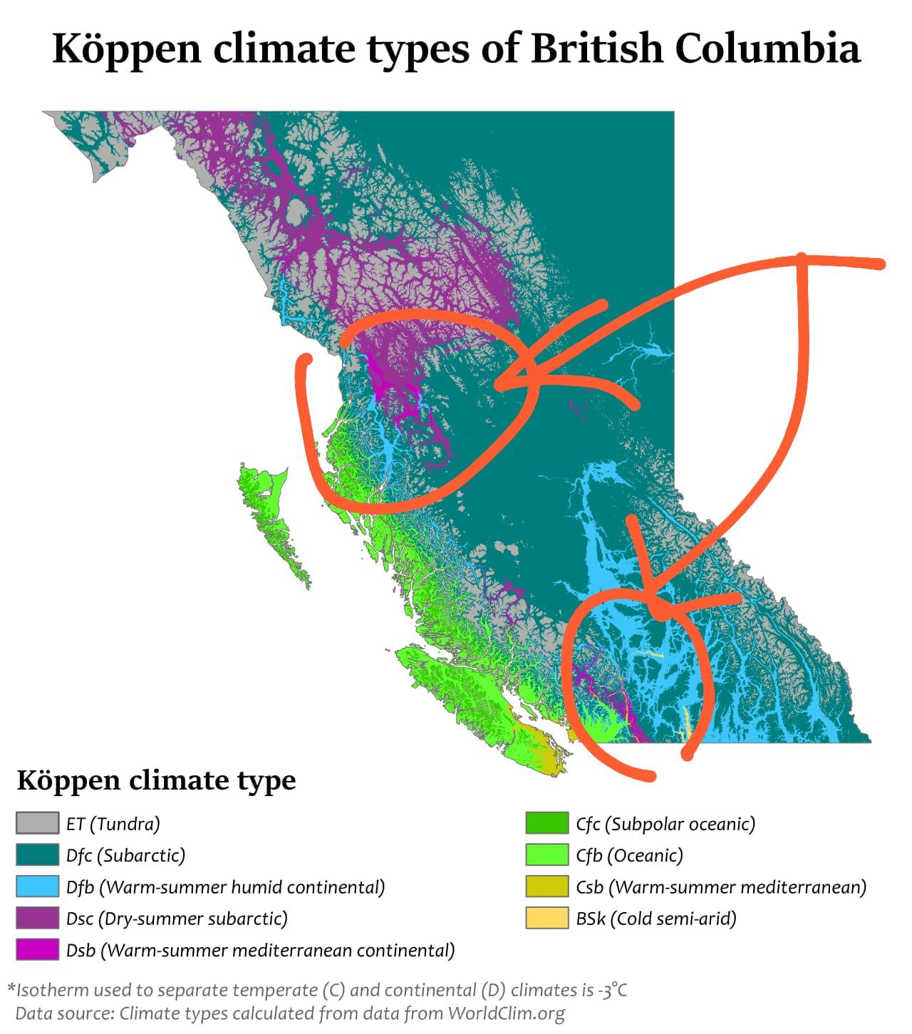
Question How livable are these parts of Canada, where Dsb climates are surrounded by ET and Dfc climates? I'm curious about what life is actually like in these areas, especially in terms of weather, accessibility, and overall quality of life

Post image
177 Upvotes

r/geography • • 2h ago

Map How much elevation change is within 20 miles of where people live, by US county: 777 ft for the typical American, 9,251 ft in Nye County, NV

Post image
49 Upvotes

r/geography • • 19m ago

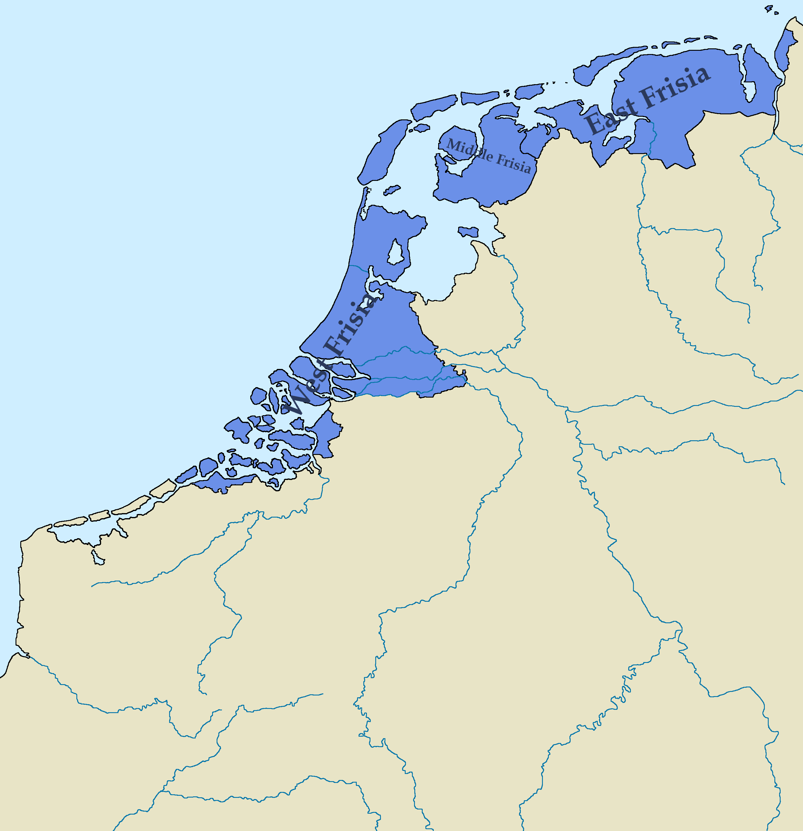
Map Map of the Kingdom of Frisia 600 AD - 734 AD, Based on various sources, combined to try and find the most accurate combination of borders.

Post image
• Upvotes